FACILITY CONDITION ASSESSMENT MANAGER
Unique Problems, Innovative Solutions
Our proprietary workflows combine advanced indoor (and outdoor) drone observations, experienced in-house professional AEC staff, and our custom 3D web-application. The ReadyVIS - Facility Conditions Management solution offers you a comprehensive platform to help you manage your ever-changing facility maintenance needs.
What is it?
Specialized Tech
Indoor "collision-tolerant" drones equiped with an HD color camera, IR camera, and flood lighting, allows us to see the darkest, dampest, nastiest locations of your facilities in crystal clear image quality.
Engineered Perspective
Backed by 50+ years as a full-service AEC firm, our team of structural engineers have the knowledge and experience dealing with the unique environments your facilities present.
Expert Control
Although not FAA-mandated, all our projects are flown by experienced Part 107 certified pilots, ensuring competent command of the UAV at all times. Ready to work at night, on weekend, whenever most convenient (or necessary) for you and your business.
How does it work?
Expert Drone Piloting
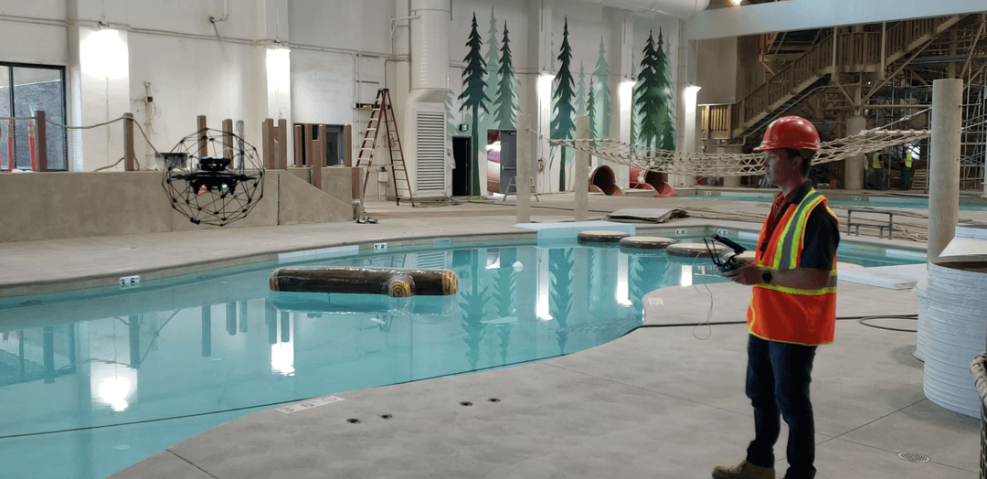
We arrange a site visit to your facility at a time convenient for your business, including at night if necessary. Our certified Part 107 pilots perform the drone observation operations after clearing scope of work with maintenance/management staff.
Data/Media Analysis
Our experienced team of professional engineers comb through the data/footage alongside the pilot, to provide in-depth analysis of the observed facility conditions. Points of Interest are categorized by condition and annotated for easy review.
Reporting/Summary
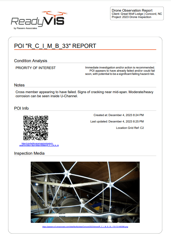
A comprehensive Executive Summary (PDF/hard copy) is provided along with reports for each POI of concern. The report includes detailed information including a QR Code for easy web-access to update the results after repairs are made.
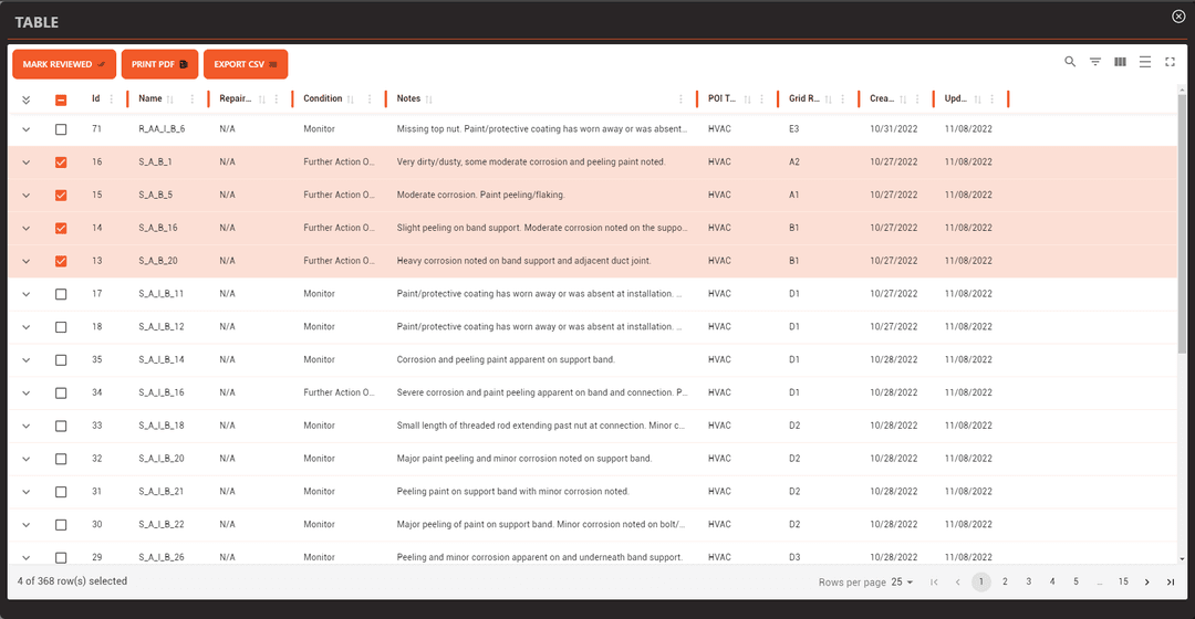
Web Application
The same results in the report are also available in the web-portal for your immediate review and use. Update the results as necessary to track progress over time. Re-visits by our team or your staff will automatically update.
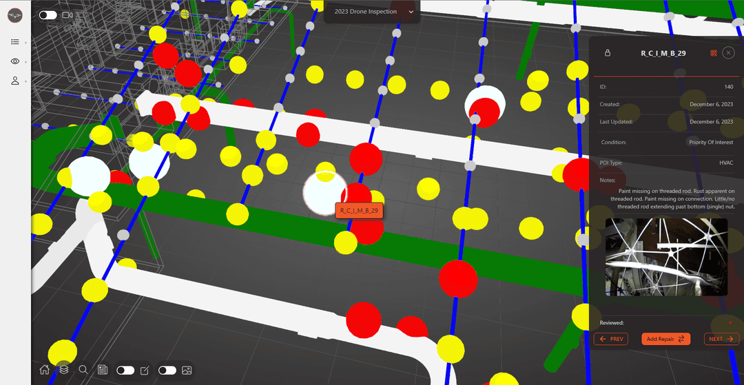
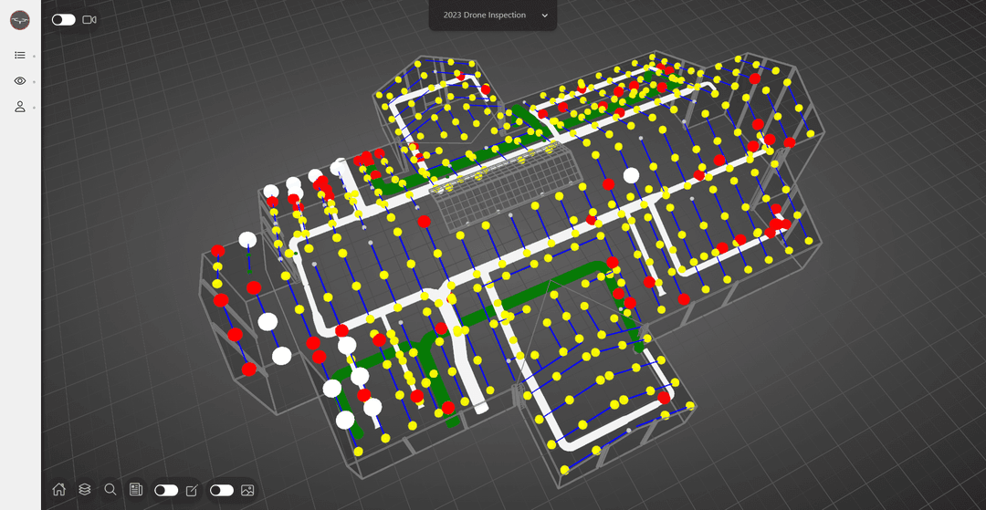
Custom Web Application
ReadyVIS Facility portal offers a powerful suite of tools at your fingertips.
3D Model/Viewport
Latest 3D web-rendering technologies provide a context-rich experience of your facility, elevating spatial awareness of your safety-critical data.
Comprehensive Results
Conditions assessment, information, and drone imagery attached to POI's, and more!. All data is available for easy review, export, and printing.
Extended Value
Update your data as necessary, track condition changes over time. Future visits by our field teams will automatically update in the model.